


MAPS TO TOUR LOCATIONS AND DIRECTIONS TO YOUR TOUR
PLEASE ARRIVE FOR YOUR TOUR 10 MINUTES BEFORE START TIME.
WATERFALL AND CASCADIA TOURS:
The meeting place for these tours is on Lake Revelstoke above the Revelstoke Dam at the 5 Mile Recreation Site. It is about a 12-15 minute drive from downtown and about 8.3 km from the TransCanada Highway turnoff at Highway 23 North.
From downtown Revelstoke, drive to the main intersection of Highway 1 (TransCanada) and turn right at the lights towards Calgary onto the highway. Drive for approx. 400 meters, and turn LEFT at Highway 23 North. Follow Highway 23 North for about 5 kms.
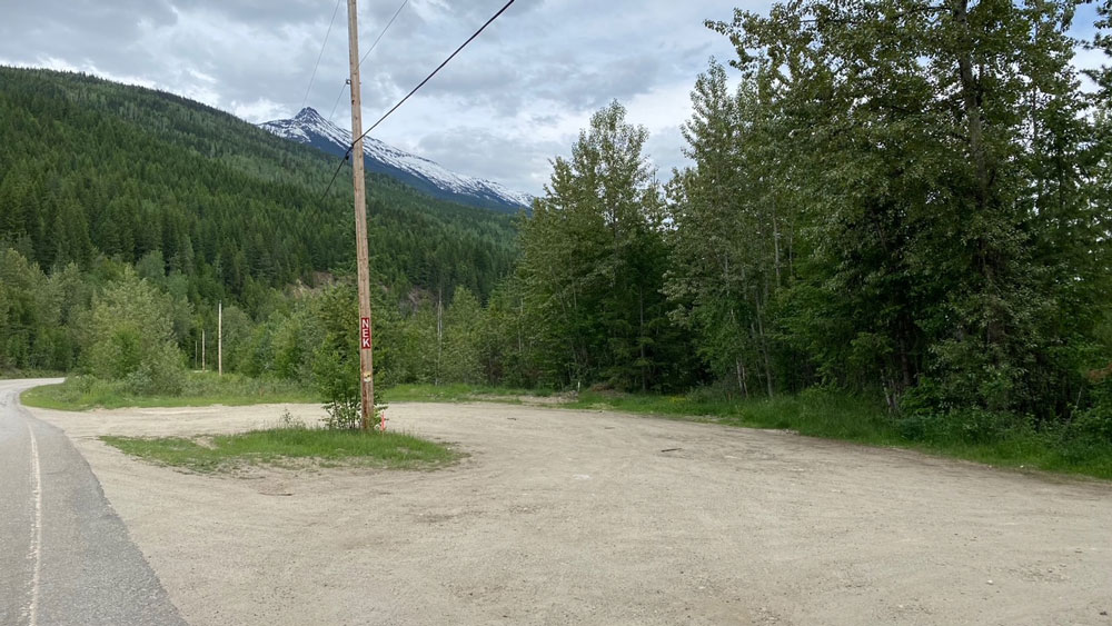
Once you get to the crest of the Revelstoke Dam, check your odometer and drive 3 km more. You will see a small road on the left with yellow barriers, and a gravel road on the right with a yellow gate. Just past the left road, there is another road where you turn left. There is a brown sign that says “5 Mile – Recreation Site – British Columbia”, and a red sign with NEK on it where you turn left.
View Waterfall & Cascadia Tour Location in Google Maps
Coordinates: 5 Mile Boat Launch (Lake Revelstoke) – 51° 4’26.00″N 118°10’26.79″W
PANORAMIC LAKE & MOUNTAIN VIEW TOUR:
The meeting place for the Panoramic Lake & Mountain View Tour is south of town on Airport Way, about a 12-15 minute drive from downtown.
Use a map or Google Maps to get to the Revelstoke Airport.
Once you see the airport entrance on your right side, it is a 4 minute (approx. 4.5 km) drive from there.
As the road finishes curving left you will see a gravel parking area on the right. You will see a telephone pole with red and white “NEK” letters and/or our vehicle and kayak trailer(s) parked at the parking area.
View Panoramic Lake & Mountain View Tour Location in Google Maps
Coordinates: 6 Mile South Launch (Upper Arrow Lake) – 50°56’4.99″N 118° 9’18.41″W
GLACIER VIEW TOUR & FULL DAY CANYON TOUR:
The meeting place for these tours is at the parking area by the FASGAS gas station on the corner of Highway 1 (TransCanada Highway) and Highway 23 North.
Transportation with our guide(s) may be included and can be arranged with us at least 24 hours before the tour.
View Glacier View & Full Day Canyon Tours Location in Google Maps
Coordinates: Carnes Creek (Lake Revelstoke) – 51°17’58.96″N 118°16’51.62”W